Norwich International Airport (NWI)
City Orientation and Maps
(Norwich, England)
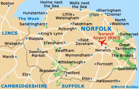
Norwich is located in the county of Norfolk, on the eastern coast. The county town, Norwich is within easy reach of many places of interest, such as Great Yarmouth, which is the area's main seaside resort and lies just 32 km / 20 miles to the east. Other notable towns and cities close to Norwich include Peterborough to the west, Cambridge and Bury St. Edmunds to the south-west, and Ipswich to the south.
To the north of the city you will find Hellesdon, close to Norwich International Airport (NWI). Also worth noting, London is located around 185 km / 115 miles to the south-west of Norfolk and can be reached in just over two hours by car, using the M11 motorway.
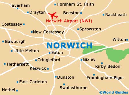
Norwich International Airport (NWI) Maps: Important City Districts
Norwich is centred around its grand castle, with the tourist information office being located nearby, just two blocks to the west, inside the eye-catching Forum building on the Millennium Plain. The city contains a number of notable medieval highlights, which include historic city walls, an Anglican cathedral and also a further Roman Catholic cathedral.
Every day in Norwich city centre a local market takes place and is one of the most historic markets in the whole of England, dating back more than 900 years.
England Map

Norfolk Map
Norwich Map